 An official website of the United States government.
  Official websites use .gov
A .gov website belongs to an official government organization in the United States.
Official websites use .gov
A .gov website belongs to an official government organization in the United States. Secure .gov websites use HTTPS
A lock or https:// means you’ve safely connected to the .gov website. Share sensitive information only on official, secure websites.
Secure .gov websites use HTTPS
A lock or https:// means you’ve safely connected to the .gov website. Share sensitive information only on official, secure websites. Register for one of three virtual public listening sessions for South Florida Clean Coastal Waters Act
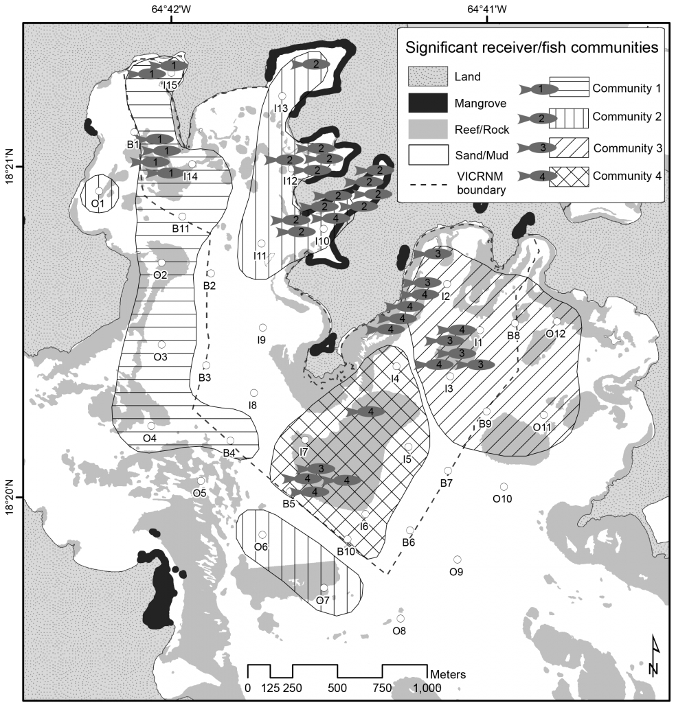
Map of telemetry results shows how four reef fish communities in St. John, USVI, overlap with marine protected area boundaries. Credit: Kendall et al., 2017.
NCCOS is developing new tools to help natural resource managers conserve essential fish habitat. One such tool uses acoustic signals to track the movements of fish, then pairs the data with NCCOS's existing seafloor mapping products to identify the fishes' habitat preferences. Dr. Mark Monaco recently presented NCCOS's advances in the coupling of acoustic telemetry and habitat mapping to attendees of the 2020 Annual American Fisheries Society virtual meeting.
The project, conducted in the U.S. Virgin Islands, Puerto Rico, and Florida, uses underwater hydroacoustic receivers placed in and around national parks and marine sanctuaries to detect acoustic transmitters surgically implanted in target fish species. The movement data recorded reveal the sizes of species’ home ranges, migratory patterns, and — when coupled with seafloor mapping data — their habitat preferences, which can help inform the setting of marine protected area boundaries and guide habitat management decisions.