Home > Explore Data & Reports > A Decade of Water Level Changes along the New River Estuary in North Carolina, USA

Citation:

Hilting, A.K., M. D. Greene, and C.A. Currin. 2021. A Decade of Water Level Changes along the New River Estuary in North Carolina, USA. NOAA Technical Memorandum NOS NCCOS #258. https://doi:10.25923/t5pn-xc77

Data/Report Type:

NOAA Technical Memorandum

Description

From 2008-2018, our program evaluated coastal marsh resilience to changes in
inundation along the New River Estuary in Marine Corps Base Camp Lejeune (MCBCL) near
Jacksonville, NC. To properly contextualize marsh parameters and processes across a range of
tidal influence, we required site-specific information on water levels, temperature, and salinity.
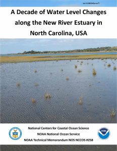
This was a challenge in that the study area was in a known coverage gap in the National Water Level Observation Network (NWLON), whose closest station was ~60 km away in Beaufort,

NC. We established secondary water level stations in two different tidal regimes, supplemented by tertiary stations at our marsh monitoring sites. This technical memorandum summarizes ~ 10
years of water level, temperature, and salinity changes at MCBCL and provides our lessons learned regarding requirements for site-specific applications of water level data.

Note to readers with disabilities: Some scientific publications linked from this website may not conform to Section 508 accessibility standards due to the complexity of the information being presented. If you need assistance accessing this electronic content, please contact the lead/corresponding author, Primary Contact, or nccos.webcontent@noaa.gov.

Explore Similar Data/Reports

About NCCOS

NCCOS delivers ecosystem science solutions for stewardship of the nation’s ocean and coastal resources to sustain thriving coastal communities and economies.

Stay Connected

Sign up for our quarterly newsletter or view our archives.

Follow us on Social

Listen to our Podcast

Check our our new podcast "Coastal Conversations"