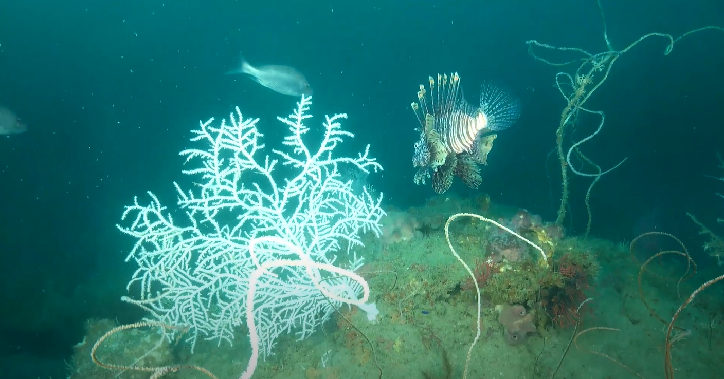
In 2010, more than 770 square miles of mesophotic and deep-sea habitats were injured by the Deepwater Horizon oil spill. In 2023, the National Oceanic and Atmospheric Administration (NOAA), the Department of the Interior, and partners completed a second year of expeditions to better understand and restore these ecosystems through the implementation of four collaborative projects.
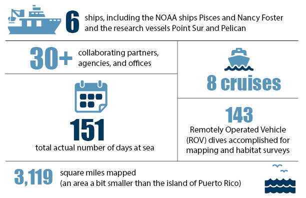
From May through October 2023, crews from NOAA, the U.S. Geological Survey, and several additional partners embarked on eight scientific expeditions across the Gulf of Mexico, spending a total of 151 days at sea aboard six different ships. This year’s expeditions continued to build on the progress made by the projects in 2022, surveying both injured and reference habitat areas, and exploring even deeper sites.
The expeditions support four projects approved by the Open Ocean Trustee Implementation Group to restore Mesophotic and Deep Benthic Communities. They’re part of restoration efforts for the Deepwater Horizon oil spill in the Gulf of Mexico.
The projects focus on seafloor mapping, developing coral propagation techniques, learning more about the diversity of life in the deep Gulf, and informing the active management of these habitats to protect against threats and provide a framework for restoration, monitoring, education, and outreach. The remote sensing data, environmental data, samples, and imagery gathered during these expeditions will advance restoration in some of the Gulf’s most inaccessible yet foundational habitats.
New technologies were tested this year, including a deep sea coral elevator and technical diving operations to help monitor corals at depth, and new capabilities for telepresence from the ships.
Here’s a snapshot of some of the work the projects completed in 2023.
Mapping, Ground-Truthing, and Predictive Habitat Modeling
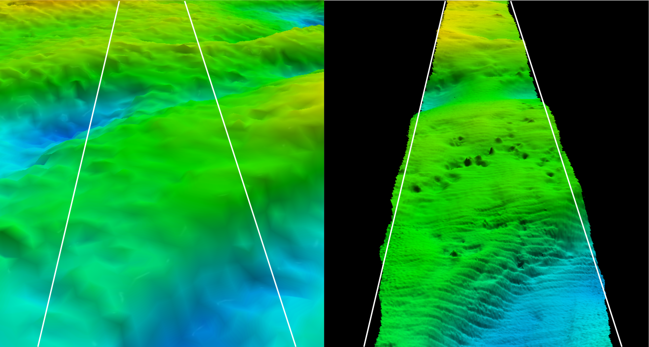
The project team conducted mapping efforts in both mesophotic (50 to 300 meters deep) and deep benthic (deeper than 300 meters) habitats to identify areas with important habitat and distinguish seabed types that will be targeted for further surveys and restoration activities. In total, 3,119 square miles of seafloor were mapped at depths ranging from 63 to 1,710 meters in 2023. Large swaths of mapping data were collected at resolutions from 32-meters to four-meters using multibeam-echo sounders mounted on the hulls of the NOAA Ships Nancy Foster and Pisces. The data collected from these efforts provided a rough view of the topography of the seafloor that was useful for identifying potentially significant features or habitats. The teams used this information to target smaller areas for higher resolution data collection by autonomous underwater vehicles (AUVs). These vehicles can produce data up to three-centimeter resolution, allowing the team to produce maps of the seafloor with extremely fine detail.
The mapping team has also been working on land to develop computer models that can predict where important coral habitat may be found across the Northern Gulf of Mexico. These models were tested at-sea in 2023 using imagery and samples collected by remotely operated vehicle (ROV) and AUV surveys, which verified whether or not coral habitats exist in the areas predicted by the model. The results of this work were used to refine the models so they can more accurately predict the presence of coral habitat in the future. Finally, the project team initiated a new collaboration with the Bureau of Ocean Energy Management to review and standardize legacy seafloor characterization information in their possession. This compilation of existing data and information supports a collaborative interagency effort to avoid unnecessary duplication of costly federal field surveys.
Habitat Assessment and Evaluation
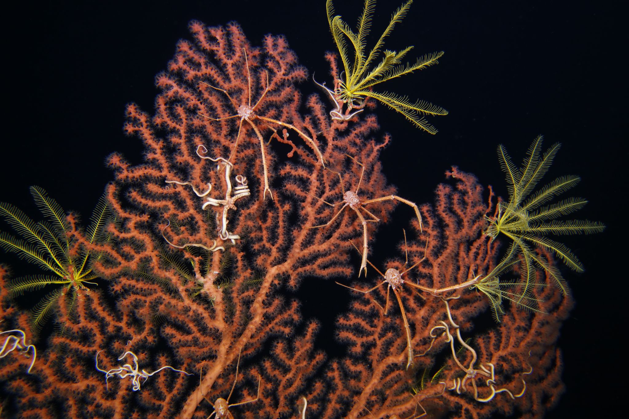
In order to determine baseline conditions and characterize key community conditions, the team collected a suite of environmental data throughout the 2023 season using a wide variety of tools and samples. This included the collection of 7,268 sediment samples, 2,771 water samples, and over 3,500 biological samples of organisms like corals, crabs, squat lobsters, and giant isopods. These samples are processed to understand almost 40 different aspects of how these communities function. The project team also completed 223 CTD rosette casts and 143 ROV dives, collecting nearly 340 hours of video of deep sea habitats with the cameras mounted on the ROVs. The team also recovered four landers that were deployed during the 2022 expedition season, and deployed 11 more. The landers are capable of logging environmental data for up to a year, allowing for long term site monitoring that will help the restoration teams better understand these habitats.
These data will help scientists analyze the community composition in mesophotic and deep benthic habitats and the abundance and distribution of specific coral species. Surveying both injured and reference habitat areas allows this project team to establish a new baseline. This allows the team to compare future surveys to distinguish between recovery and natural variability over time, as well as measure the success of restoration efforts.
Coral Propagation Technique Development
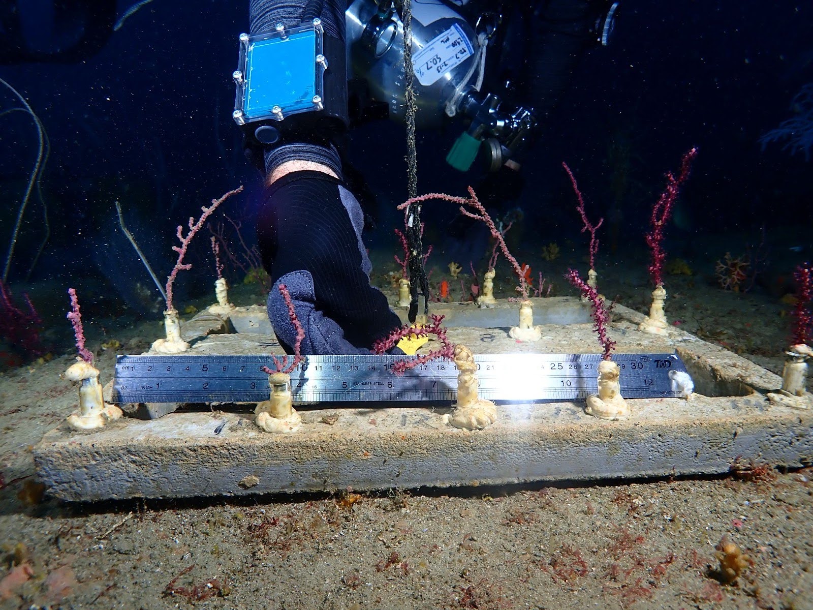
In May 2023, this project team completed their first attempt at returning mesophotic octocorals to the seafloor using a deep sea coral elevator, placing nearly 200 fragments of three octocoral species 230 feet below the surface. In July, a team of technical divers returned to the site to monitor the coral fragments that were planted in May, and to deploy tiles to serve as artificial substrate where new corals may settle and grow. The divers discovered 95 percent of the corals placed in May had survived and appeared healthy!
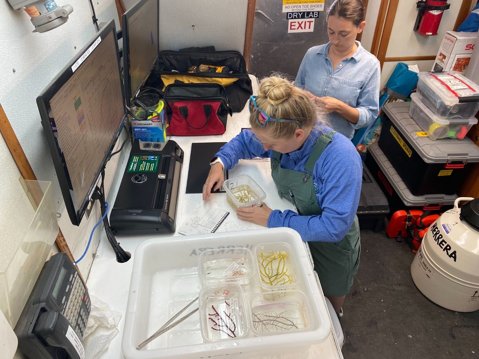
Across the eight expeditions this season, ROVs were used to obtain 164 coral samples that were brought to labs and aquariums to support restoration technique development including improved methods for coral husbandry and studies into their reproduction and genetics. In addition to three federal labs that have been caring for these corals since 2021, the team established partnerships with three public aquariums in 2023. This network of partners expands the capacity to understand the biology, growth, reproduction, and best practices for restoration of these coral species.
Active Management and Protection
The Active Management and Protection project team ensured that each expedition in 2023 was documented with photos, videos, and, in one case, audio that resulted in a “Coastal Conversations” podcast episode. The collection of this media is a vital part of our efforts to share these habitats and the restoration work with stakeholders and the general public. Education and outreach efforts in 2023 also included establishing partnerships with four public museums and aquariums – stay tuned for exhibit openings that give the public a deeper look at these habitats and restoration activities in 2024!
The team also connected at-sea restoration efforts to audiences on land by installing two Starlink antennas on the NOAA Ship Nancy Foster, providing an internet connection to stream live video and audio from ship to shore. In the first field season using this technology, the team hosted 13 livestream events with small target audiences, reaching over 750 people. These events laid the groundwork for the telepresence team to plan livestream events for broader public audiences in the 2024 field season.

