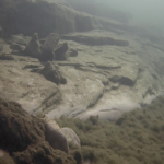
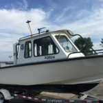
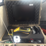
NCCOS teamed up with the Office of National Marine Sanctuaries and Great Lakes Environmental Research Laboratory to collect 322 underwater videos off the coast of Wisconsin in Lake Michigan. The videos are paired with sonar data acquired in June 2017, as well as coastal bathymetry data collected by the National Coastal Mapping Program, to develop maps of underwater resources in Wisconsin waters and support the proposed Wisconsin – Lake Michigan National Marine Sanctuary. Together, the videos and sonar data reveal new perspectives of the geology, ecology and maritime heritage of this seldom-explored swath of the lake. The field mission is part of a three-year NCCOS-funded study to better understand ecological and maritime heritage resources in the proposed sanctuary.