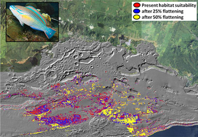
Scientists from NOAA’s National Center for Coastal Ocean Science (NCCOS) have developed a cost-effective modeling technique for mapping the most important coral reefs for keystone fish species in the U.S. Caribbean.
The techniques used only two types of existing data: (1) a detailed map of the seafloor bathymetry collected from airborne laser altimetry, also known as LiDAR; and (2) geo-referenced underwater sightings of fish collected by NCCOS scientific divers. Through combining the underwater sighting data with the remote sensing data and using non-linear models and mapping the predictions across space, the scientists provided valuable ecological information on key environmental patterns.
The researchers then mapped the spatial distributions of key herbivores, carnivores and a fish species that is an important indicator of coral reef health. This information can support coral reef managers in identifying essential fish habitat and potentially resilient reefs and communities, and can inform place-based management strategies.
In the future, this novel multi-scale technique will be used to examine the impact of climate change related to coral collapse in reef communities.
