NOAA’s National Centers for Coastal Ocean Science kicked off the eighth year of a mission to explore and map underwater realms of the U.S. Caribbean aboard the NOAA Ship Nancy Foster. For many of the areas visited during this expedition, it’ll be the first time they’ve ever been studied or mapped.
During a cruise from March 28 through April 16, researchers will be taking a close look at high-priority sea floor habitats between three and 30 kilometers off the southern coasts of St. Thomas and St. John. These areas were selected because of their ecological significance to commercially important fisheries and the need to update nautical charts in the region.
The data collected during the expedition will be used to paint a clearer picture of the U.S. Virgin Islands underwater habitats and the marine life they support. This info is critical for the resource managers charged with protecting these fragile ecosystems.
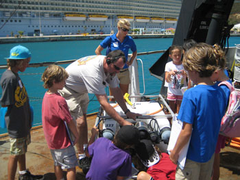
There are several outreach and education programs planned to engage school children, university students, fishers and politicians while the ship is in port in Charlotte Amalie, St. Thomas.
NCCOS is undertaking this ongoing, multi-year mapping effort at the request of the Caribbean Fisheries Management Council, the National Park Service, and the University of the Virgin Islands. The work is supported by the Coral Reef Conservation Program.

