In Southeast Florida we are developing an early warning system that tracks saltwater intrusion and water table changes to help decision makers and managers plan, adapt, and avoid potentially catastrophic infrastructure failures.
Why We Care
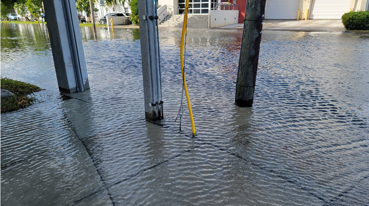
As sea level rises, coastal water tables rise too, flooding foundations, buried utilities, and other subsurface infrastructure. With less room below ground to store infiltrated rainfall, surface flooding increases as well. Rising seas will increase saltwater intrusion into coastal areas, with potentially devastating corrosion impacts on foundations and other buried infrastructure. This is a major issue in Southeast Florida, a highly populated urban area vulnerable to sea level rise.

What We Are Doing
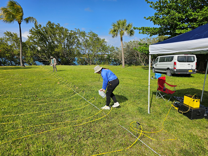
This community-directed spending project, led by Florida International University, is establishing new pilot coastal subsurface monitoring systems in Southeast Florida’s highly developed, near-shore and barrier island environments. The monitoring systems will measure existing subsurface water conditions, document change as sea levels rise, and provide early warning of changing subsurface conditions. Researchers will collect high spatial and temporal resolution data of near-shore saltwater interfaces, water table positions, unsaturated zone moisture conditions and dynamics, and corrosion potential.
Collected data will be used to quantify the impacts of sea level rise on near-shore subsurfaces, inform potential early warning systems for groundwater flooding, enable advanced modeling of the unsaturated zone and water table, and inform proper design and protection of subsurface infrastructure.
Benefits of Our Work
This work will provide early warning of changing subsurface conditions that permit coastal managers, utilities, municipalities, and building officials to plan, adapt, and avoid potentially catastrophic infrastructure failures. Additionally, national, state, and local governments, and other collaborative regional research and adaptation task forces could use the monitoring data to accelerate strategies for addressing sea level–related water and saltwater management needs in partnership with critical federal partners such as NOAA, the U.S. Geological Survey, the National Institute of Standards and Technology, and the U.S. Army Corps of Engineers.

