Advancing Pollution Science
NCCOS conducts national and long-term research and assessments to understand the effects of contaminants, nutrients, and hypoxia. Measuring contaminants in mussels and oysters, or the breadth of Gulf of Mexico’s dead zone, where agricultural runoff from the middle of the country leads to summertime conditions that cannot support bottom-dwelling marine life. These measurements and predictions allow better decisions affecting health and seafood safety by local, regional, and upstream management.
Molecular Technologies
NCCOS scientists employ molecular technologies such as genomics, proteomics, and metabolomics to assess changes at the molecular level (gene, protein, and metabolite, respectively) in response to coastal pollution. State-of-the-art instrumentation, such as MiSeq (an integrated instrument that performs clonal amplification and DNA sequencing) and Nuclear Magnetic Resonance (NMR), are some of the tools used. These are followed by high power computer applications to conduct bioinformatics, a process of analyzing the molecular data and determining relationships between environmental pollution stressors and molecular changes.
Contaminant Sampling and Chemical Measurement Technologies
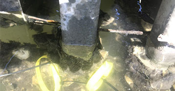
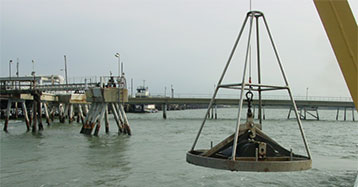
NCCOS scientists identify and measure chemical contaminants with a variety of new sampling technologies such as passive samplers such as silicone bands, which absorb chemicals in the environment, to active water filtration samplers that integrate concentrations over time. We are experimentally developing rate constants that will allow quantification of organic compounds from multiple sampling platforms. Our scientists are refining analytical techniques to improve organic and inorganic chemical detection in water, sediment, and tissue samples. We are also working with coastal resource managers to deliver data on new and emerging chemicals of concern such as per- and poly-fluorinated substances (PFAS).
Chemical contaminants in our coastal and Great Lakes regions give rise to concerns about their potential adverse biological effects and impacts on the delivery of ecosystem services. Chemical contaminants enter aquatic ecosystems via agricultural, urban, suburban, golf course and resort runoff, direct inputs from chemical spills, industrial activities and municipal wastewater treatment processes, and atmospheric deposition. NCCOS research aims to characterize the risk chemical contaminants pose to coastal health and work with resource managers to identify strategies to mitigate impacts and protect sensitive ecosystems. NCCOS scientists are engaged in laboratory and field activities that are providing new insights into where contaminants go once they enter coastal waters and how they change over time. Technology is being developed to improve contaminant monitoring and assessment.
Contaminant Spatial Analysis
NCCOS scientists are assessing the scope and extent of land-based sources of chemical and biological contaminants in sensitive areas such as coral reefs, marine protected areas, and national seashores. By measuring a broad suite of pollution indicators (legacy and current use chemicals, bacterial loads, nutrients, and benthic community toxicity/composition), scientists can provide a condition assessment for the specific ecosystem. Advanced tools, including collaborative databases and statistical and geospatial analysis programs, are used to synthesize and map the data. NCCOS scientists are expanding their capabilities to use machine learning and artificial intelligence to predict contaminant concentrations. These studies provide the baseline data requested by natural resource managers, help managers understand the primary drivers of pollution, and help identify future projects to reduce land-based sources of pollution and restore and conserve critical habitats.


