In 2022, NOAA and partners completed eight expeditions in the Gulf of Mexico in support of four projects designed to help restore mesophotic and deep benthic communities damaged by the 2010 Deepwater Horizon oil spill.
The sixth expedition took place from September 6 - 27 aboard R/V Point Sur in the northern Gulf of Mexico to assess, characterize, and map deep benthic communities, with joint objectives for two of the four projects: Mapping Ground-truthing and Predictive Habitat Modeling, and Habitat Assessment and Evaluation. The mission was led by scientists from NOAA and the U.S. Geological Survey, with partners and collaborators from University of Nevada-Reno, University of Georgia, and University of Southern Mississippi.
Rebecca Ruiz, a NOAA Center for Coastal and Marine Ecosystems (CCME) scholar, who is pursuing her undergraduate degree at Texas A&M University-Corpus Christi , was also onboard. CCME is one of four educational Cooperative Science Centers funded under NOAA’s Educational Partnership Program with Minority Serving Institutions.
Following a recent opportunity to conduct fish diversity field research in the Philippines, Ruiz was invited to join the first leg of the R/V Point Sur mission where she took part in sample collections, data analyses and more. “I learned about the behind-the-scenes of sample collection, stretched my critical thinking and problem-solving skills – both practical and mechanical – and became familiar with operating all new kinds of equipment. More importantly, however, I learned just how much work and effort goes into collecting the data that advances our knowledge for creating better management strategies that protect the health of our oceans” said Ruiz.
Ruiz is currently working on two research projects to investigate the effects of a) human activity on species diversity in the Philippines and b) the sublethal effects of hypoxia on Atlantic croaker. Ruiz’s research interests include restorative ecology and damage evaluation of both marine habitats and populations for the purpose of informing better ocean resource management strategies for scientists and local communities.
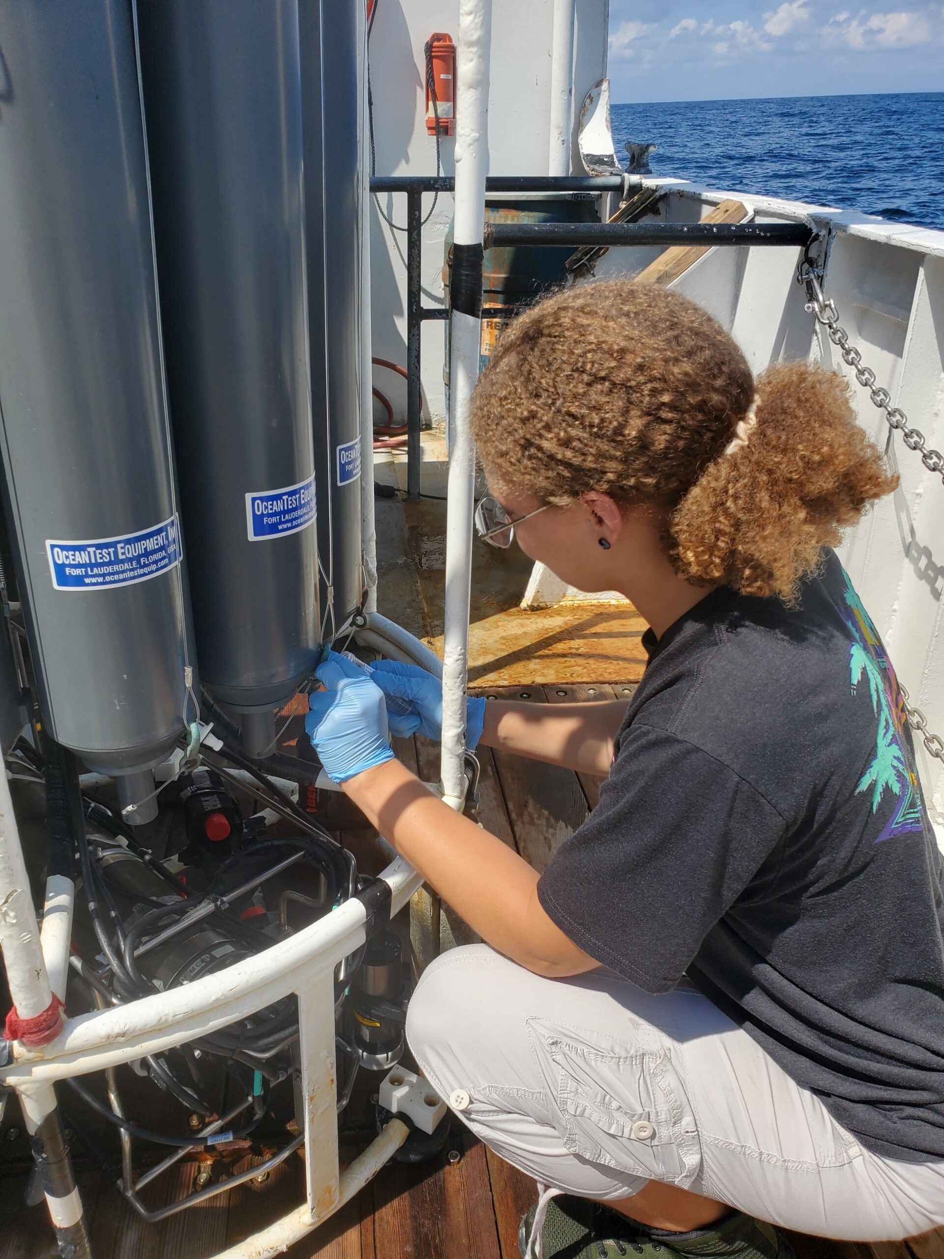
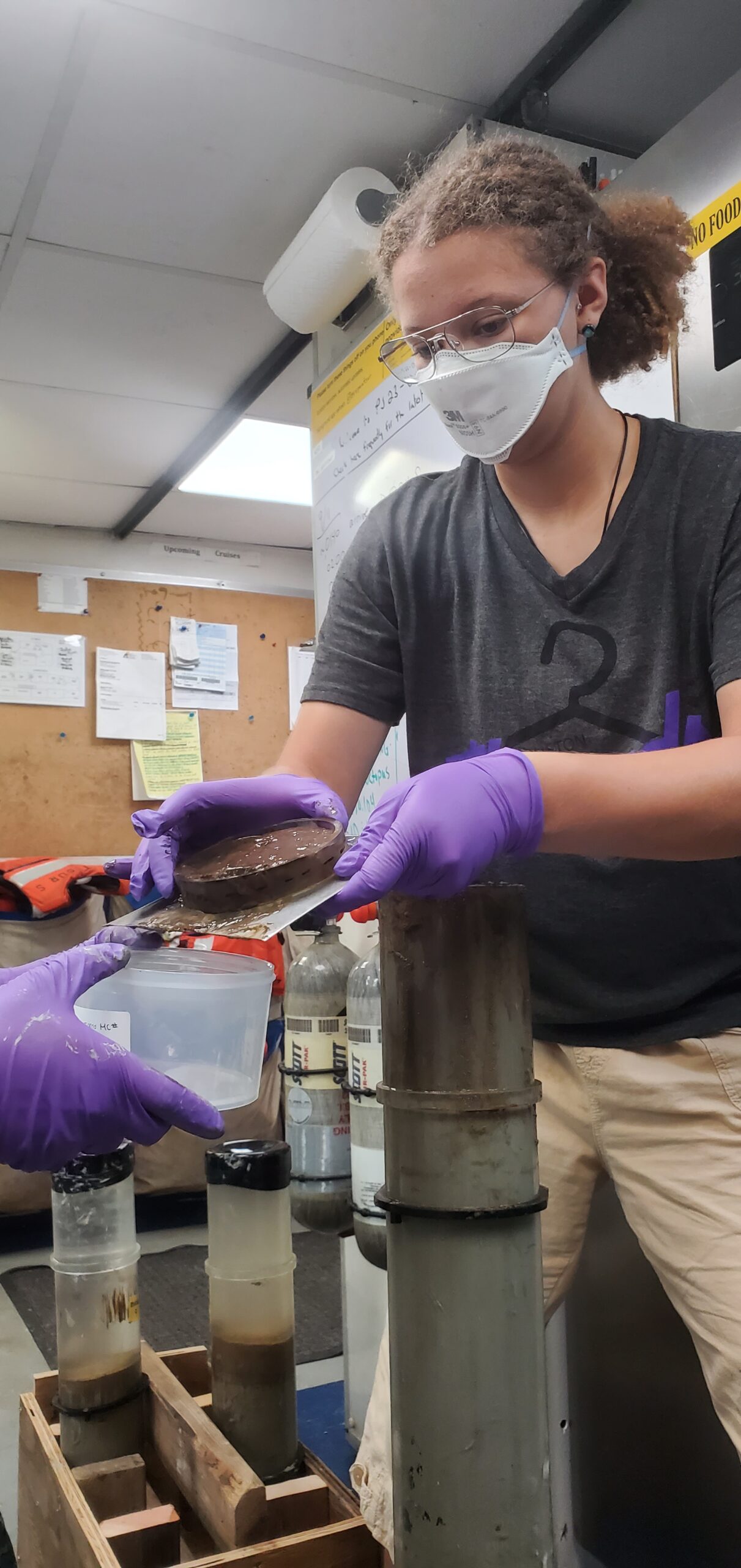
During Leg 1 of the cruise, the expedition visited 23 areas that were sampled during the Deepwater Horizon injury assessment, ranging from 209 to 2,384 meters depth. At each station the team conducted multicore deployments, sub-bottom profiling, and Conductivity, Temperature and Depth (CTD) sensor operations. Multicorers are a tool used to sample soft-sediment habitats for faunal, geochemical, and physical properties. CTD rosette casts help define water column oceanographic and nutrient properties and collect eDNA samples. Sub-bottom profiling allows scientists to ground-truth multibeam mapping efforts and determine sediment thickness at sampling locations.
 |
 |
| Retrieving water samples from the CTD for particulate organic matter and eDNA analyses. Credit: Colleen Young - Affiliation: USGS | Slicing and storing target increments of mud samples from multicores. Credit: Colleen Young - Affiliation: USGS |
Leg 1 Cruise Stats:
- Sampled 23 individual stations
- Collected 182 sediment cores resulting in subsamples for the different analyses (653 faunal samples, 568 geochemical samples, 238 physical samples)
- Conducted 19 CTD to a maximum depth of 2371 m, resulting in subsamples for the different analyses (156 nutrient samples, 120 eDNA samples, 64 particulate organic matter samples)
- Conducted sub-bottom profiling transects over 260 km in the Gulf of Mexico
Collectively, this work will help assess the status of deep-sea habitats in the Gulf of Mexico, in both areas injured by the 2010 Deepwater Horizon spill and reference areas, to inform our understanding of natural recovery trajectories as well as our efforts to restore and manage these habitats.
 Official websites use .gov
A .gov website belongs to an official government organization in the United States.
 Secure .gov websites use HTTPS
A lock or https:// means you’ve safely connected to the .gov website. Share sensitive information only on official, secure websites.
 Register for one of three virtual public listening sessions for South Florida Clean Coastal Waters Act