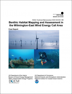
A report published by NCCOS and the Bureau of Ocean Energy Management (BOEM) provides the most comprehensive ecological study of an offshore Wind Energy Area (WEA) near Wilmington, NC. The Outer Continental Shelf located off of North Carolina has some of the best conditions to support offshore wind energy in the southeast U.S., according to the BOEM. Because of the potential for cumulative impacts to sensitive marine ecosystems as a result of the construction or operation of offshore energy facilities, BOEM commissioned an assessment of the natural resources of one of three areas of interest in NC, the Wilmington East WEA.

The report provides a map of the entire WEA that identifies hardbottom essential fish habitat and maritime cultural resources. The findings were used by BOEM to reduce the size and boundaries of the original area of interest to the WEA and exclude some of the largest clusters of hardbottom rocky reefs in the area. Read more about the project in the storymap.
Included in the report are a complete description of the sea floor surface geology and a baseline assessment of benthic biological communities and habitat use by fish assemblages of hardbottom habitats in the Wilmington-East Wind Energy Area. Maps with acoustic imagery from intensive seafloor mapping that characterize and delineate the distribution of different hardbottom habitats (rocky reef ledges, mixed hardbottom rubble, low-relief pavement, shipwrecks and artificial reefs) are used to display all of the data collected and processed to inform future siting of turbines within the WEA.
Modern hydrographic survey methods were used over two years and four research cruises to complete the coverage of the Wilmington-East WEA. Fishery echosounders were used to remotely sense and map the distribution and density of fish in the area. The new seafloor imagery and acoustically-derived fish density maps were used to identify and delineate natural hardbottom habitats and shipwrecks. A rigorous diver visual assessment was conducted on those habitats to describe the benthic and fish communities, the seasonal changes in communities, and potential influences of sand and sediment movement around the hardbottom habitats. Watch an informative video on how our work will be used by BOEM in potential wind farm development.
The research was conducted under cooperative and inter-agency agreements between BOEM, NCCOS, University of North Carolina Institute of Marine Sciences, Geodynamics Group, LLC, University of North Carolina at Wilmington
For more information read the project page or contact Chris Taylor.
