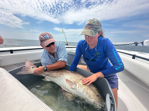
NCCOS scientists embarked on their first fish telemetry field mission to support the NOAA Climate Ecosystems and Fisheries Initiative (CEFI). CEFI is a cross-NOAA effort to build the nationwide, operational ocean modeling and decision support system needed to reduce impacts, increase resilience, and help adapt to changing ocean conditions. Telemetry is the process of collecting and transmitting data from remote sources, using sensors and other devices, which are used to track fish movements in this study. Fish were tagged using acoustic transmitters that will last for two years and collect temperature and depth information while the fish are being tracked. The team tagged 33 striped bass and 27 red drum throughout Chesapeake Bay, with the largest red drum coming in at 127 cm.
Next steps include additional tagging in the southern part of the Bay, tagging of migratory striped bass in the winter, and adding to the existing network of acoustic receivers that listen for tagged fish, in Chesapeake Bay, by deploying 26 additional receivers later this year. The data generated by these tagged fish will be paired with environmental and geographic data to create distribution models for striped bass and red drum and project them under future climate scenarios.
This project is in partnership with NOAA’s Chesapeake Bay Office, Virginia Institute of Marine Science, and the Atlantic Cooperative Telemetry Network, as well as local fishing guides, with additional field support provided by Maryland Department of Natural Resources.
