
In response to repeated nuisance flooding events that have impacted operations and visitor access at the Battleship NORTH CAROLINA, NCCOS scientists are partnering with the Battleship to re-envision the grounds surrounding the historic WWII battleship.
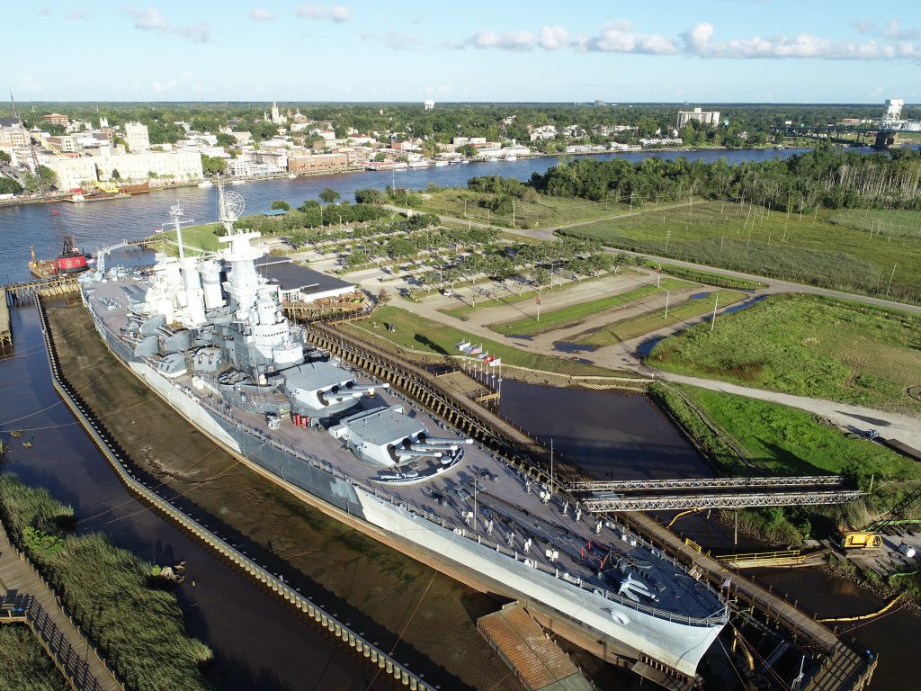
The USS NORTH CAROLINA, a National Historic Landmark that serves as North Carolina’s official memorial to WWII veterans, is a highly treasured cultural resource and one of the most frequented tourist attractions in the state with > 250,000 visitors annually. Since 1961, the USS NORTH CAROLINA has been moored in a dredged slip on the Cape Fear River among more than 2,000 acres of tidal wetlands and intertidal shoreline on Eagles Island, directly across from Wilmington, NC. The frequency and severity of flooding events along this stretch of the river has increased dramatically with 50% more flooding events in the past 15 years than during the previous 60 years combined. “Sunny Day” flooding at Battleship results in restricted access to visitors and loss of revenue.
The landscape redesign, called “Living With Water,” involves converting two acres of impervious surface to tidal wetland and installing a living shoreline along the Battleship’s berth. NCCOS scientists, in addition to advising on living shoreline design, recently instrumented the site with water level gauges and collected Unmanned Aircraft Systems (UAS)-imagery (aka drone footage) that will be used to create a high-resolution elevation model of the project area to support the redesign effort.

This project increases wetland habitat along an urbanized stretch of the Cape Fear River and serves as an outdoor classroom, an opportunity to educate visitors about the value of nature-based solutions to coastal hazards and a model for responding to the challenges of nuisance flooding events.