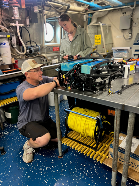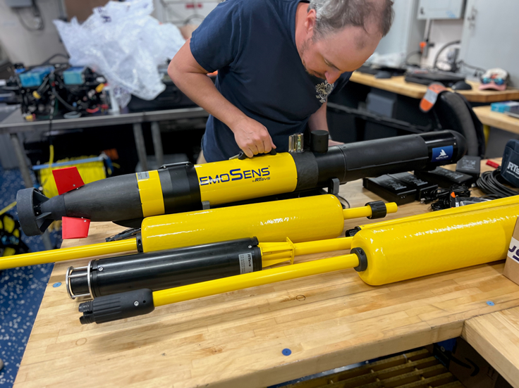
We are studying the underwater hardbottom habitats in Carolina Long Bay, a wind energy area off the coasts of North and South Carolina currently under lease by the Bureau of Ocean Energy Management. The habitats in this area support a variety of fish and other marine life. By understanding these essential fish habitats better, we can protect them while supporting sustainable offshore development.
Why We Care
The Carolina Long Bay Wind Energy Area is home to essential fish habitats, vital for many fish species’ life cycles, supporting spawning, breeding, and feeding. NCCOS uses advanced mapping technologies, such as multibeam sonar, remotely operated vehicles (ROVs), autonomous underwater vehicles (AUVs), and drop cameras, to accurately map and characterize these habitats, ensuring effective identification and protection of essential fish habitats. By safeguarding these areas, we help maintain healthy marine ecosystems that are crucial for the local fishing industry and biodiversity.
This research balances environmental conservation with the development of the new blue economy, including offshore wind energy. Detailed data and accurate maps drive responsible decision-making for sustainable development. Protecting these habitats also benefits fisheries by maintaining stable populations of commercially valuable species, supporting sustainable fishing practices. The insights gained can guide future policies and projects, balancing economic growth and ecological preservation.
What We Are Doing
This project will use experimental mapping and predictive modeling to develop best practices for characterizing hardbottom habitats in offshore wind energy areas. The experimental mapping campaign will use a large research vessel, remote sensing tools, and uncrewed imaging systems to collect new data on diverse seafloor types in Carolina Long Bay.
On the research vessel, mapping begins with overnight multibeam echosounder surveys processed to the best possible resolution. Experienced survey technicians analyze the sonar data with computer scripts to identify sites for further investigation. This precise data analysis helps pinpoint specific areas where additional tools should be deployed to interpret the seafloor substrate and habitats.
During the day, three small boats are deployed, each equipped with an AUV, ROV, or drop camera to capture high-quality images and videos of the ocean floor at the selected sites. These data, linked to high-resolution acoustic tracking and GPS, allows accurate positioning of visual information onto the seafloor maps. Statistical models relate the visual observations to the remotely sensed depth and texture to provide a comprehensive understanding of the ocean floor habitats. AI technology efficiently analyzes the photos and videos, aiding in the study of diverse marine habitats in Carolina Long Bay. This thorough approach ensures that these habitats are meticulously documented so that they can be better understood.

What We Found
By integrating multibeam sonar data with high-resolution images and videos from AUVs, ROVs, and drop cameras, the team aims to identify and map essential fish habitats with precision. These comprehensive data will reveal the locations and characteristics of both high-relief and low-relief hardbottom habitats, which are still somewhat unknown. This research is currently in progress; once the team has completed their data collection and processing, the findings will be thoroughly analyzed and published in research papers and technical reports.
Benefits of Our Work
By employing remote sensing methods, uncrewed imaging devices, and AI technology, this research enhances our ability to accurately map and characterize marine habitats in wind energy areas and other managed areas of the ocean. These methods improve our capacity to identify and protect essential fish habitats, supporting the responsible development of new blue economy industries. Additionally, the data and methodologies from this study will provide new recommendations for identifying habitats near other wind energy areas currently in various stages of development. Furthermore, this research supports the long-term viability of fisheries and other marine industries, fostering a balanced relationship between human activities and the natural environment.
